hub / github.com/LiJiangnanBit/path_optimizer_ilqr
github.com/LiJiangnanBit/path_optimizer_ilqr @main
Chat with this repoBrowse by type
What it actually does AI analysis from the code graph — generated when you open this
loading…
README
path_optimizer_ilqr
Path planning for autonomous vehicles.
The problem formulation is basically the same as path_optimizer and path_optimizer_2, but solved through constrained ilqr.
Demo
Yellow line: initial path;
Blue dots: free space boundaries;
Features
- Problem formulated under the frenet frame;
- Kappa and kappa rate constraints;
- Compared to the previous work, there is less accuracy loss on the safety constraints and the vehicle dynamics due to the ilqr solver.
Method
(...)
Depencencies
- Tested on ROS Kinetic (Ubuntu 16) and Noetic (Ubuntu 20);
- Other dependencies: glog, gflags, grid_map;
- Put these ROS packages in your ros workspace: ros_viz_tools, tinyspline_ros.
Usage
A png image is loaded as the grid map. You can click to specify the global reference path and the start/goal state of the vehicle.
roslaunch frenet_ilqr_test demo.launch
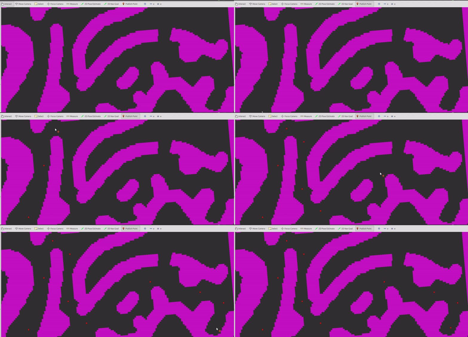
(1) Pick reference points using "Publish Point" tool in RViz.
- Pick at least six points.
- There are no hard and fast rules about the spacing of the points.
- If you want to abandon the chosen points, just double click anywhere when using the "Publish Point" tool.
- You can replace
gridmap.pngwith other black and white images. Note that the resolution indemo.cppis set to 0.2m, whick means that the length of one pixel is 0.2m on the map. - In application, the reference path is given by a global path or by a search algorithm like A*.
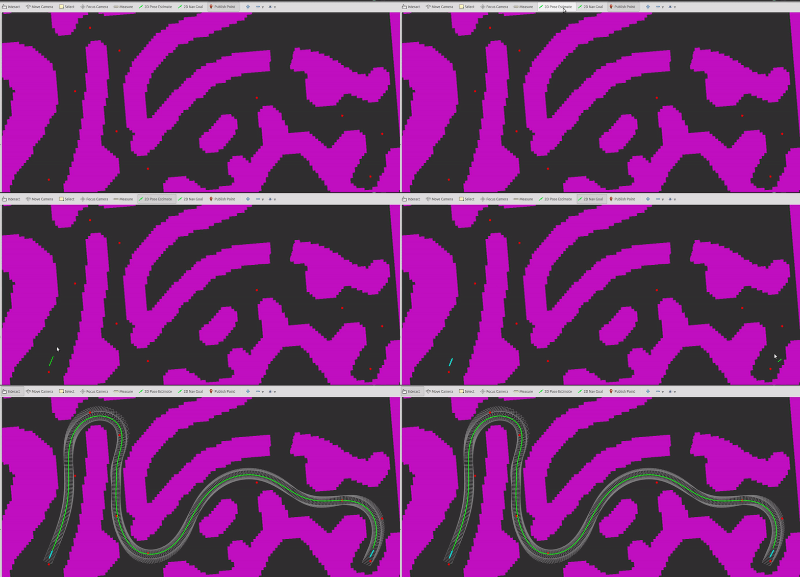
(2) Pick start state using "2D Pose Estimate" tool and pick goal state using "2D Nav Goal" tool.
- Currently, it's not strictly required to reach the goal state. But this can be changed.
- The start state must be ahead of the first reference point.
Core symbols most depended-on inside this repo
Shape
Languages
C++100%
Modules by API surface
src/path/path_costs.h31 symbols
src/test/eigen2cv.hpp23 symbols
src/solver/problem_manager.h23 symbols
src/solver/solver.h12 symbols
src/path/spline.cpp12 symbols
src/solver/variable.h9 symbols
src/path/spline.h8 symbols
src/path/free_space.h8 symbols
src/test/reference_line_processor.h7 symbols
src/path/path_problem_manager.cpp7 symbols
src/test/reference_line_processor.cpp5 symbols
src/path/reference_line.cpp5 symbols
For agents
$ claude mcp add path_optimizer_ilqr \
  -- python -m otcore.mcp_server <graph>