github.com/bilawalsidhu/gods-eye-view @main
Chat with this repoBrowse by type
What it actually does AI analysis from the code graph
README
🌐 God's Eye View
A spy-satellite simulator in your browser — then you realize the sources are public and the data is real.
Photorealistic 3D globe. Live aircraft, ships, satellites, earthquakes, traffic, and public cameras, with clearly labeled modeled views where a live feed is unavailable. Hands-free voice control powered by a realtime AI agent.
No place left behind.


▶️ From the project behind the viral God's Eye View series (formerly WorldView) — 5M+ on YouTube
Quick Start · First Five Minutes · Talk to It · What's Live · Under the Hood · Keys · Costs
🌍 Why This Exists
You asked, so it's happening. God's Eye View is open source. Track the world live. Talk to it. Break it. Extend it.
Most open-source intelligence is a pile of browser tabs. The signals are abundant, but the interface is the bottleneck. God's Eye View turns those signals into a place: the world is already broadcasting — flight transponders, ship beacons, orbital elements, seismographs, public cameras — and this makes it visible on a photorealistic 3D Earth in real time. No classified clearance required; it's public signal all the way down, and the interface runs in your browser, under your control.
Half the magic is that it looks like a forbidden cockpit. The other half is that every line of code is inspectable.
The live layers are grounded in public feeds: the airliner crossing your screen is reporting telemetry, the camera is installed at a published location, and the ISS position is propagated from current orbital elements. The client deliberately renders flights one polling interval behind real time so it can interpolate smoothly. Some experiences are modeled rather than live: keyless traffic is labeled as a simulation, camera poses are estimated until calibrated, and launch ascent playback is marked RECONSTRUCTED ESTIMATE. Each layer keeps its source and freshness state visible, including partial, delayed, simulated, and unavailable states.
🎛️ What This Thing Does
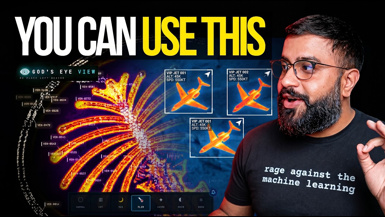
▶️ The full walkthrough of everything below, on YouTube
- 🛩️ Cockpit view: Ride inside a tracked flight — the camera holds the terrain under you all the way down.
- 📡 Contacts: A 250 km roster of everything near your target — step through live aircraft and drop into any cockpit.
- 🎯 Click-to-track anything: Camera locks on, draws a fading trail, surfaces full metadata — and a tracked fire or vessel hands you off to the nearest live camera in one click.
- 🖊️ Voice whiteboard: Speak annotations onto the world — real boundary polygons, marks, and routes.
- 🛫 3D hangar: Real per-class aircraft models — 787, ATR-72, Citation, Bell 206, MQ-9 — and a tracked contact swaps from glyph to 3D model as you close in.
- 🎨 Reskin reality: GLSL sensor looks over the normal globe — CRT, NVG, FLIR/thermal, Noir, Snow.
- 🟩 Detection overlay: Screen-space bounding boxes and IDs on everything in view.
- 🎖️ Military HUD: Tactical heads-up display with intelligence-style telemetry.
- 🌐 Global Context: Stage the full situational picture with one switch — and get your exact view back when you leave.
- 🎥 Scene director: Capture cinematic camera tours for clips and demos.
- 🔗 Share Links: Camera, style, layers, and even one tracked target serialize into a URL — a live target is a handoff, not a bookmark.
- 🏠 Reset Globe: One control — or one sentence — back to the full Earth.
⚡ Quick Start
Requires Node.js 24.14.x or 26.x (enforced by package.json).
- Copy
.env.example→.envand setGOOGLE_MAPS_API_KEY. - Install and run:
npm install
npm run dev -- --host localhost --port 4173
- Open
http://localhost:4173. Cold start settles in under two seconds on a recent laptop (median 1.86 s in a point-in-time M5/Chrome capture — docs/PERFORMANCE.md; a comparison baseline, not a hardware requirement). A first-run card offers to stage a mission for you — Live Contacts, Space Missions, Environmental — or leaves you to explore manually.
[!TIP] Not a coder? Have an AI do this whole page for you. A one-click installer is in the works — until then, install a coding agent (Claude Code, Codex, Cursor, or Antigravity) and paste this:
text
Clone https://github.com/bilawalsidhu/gods-eye-view and set it up on my machine.
Install everything it needs, walk me through getting the required Google Maps API
key step by step (plus any optional free keys I want), put the keys in .env, and
help me set a billing alert and a usage quota on the Google key so I can't
overspend. Then start the dev server and open it in my browser. I'm not a
developer — explain what you're doing as you go, and ask me before any step
that could cost money.
That one key is the whole entry fee. Everything in this README is color-coded — 🟢 needs nothing · 🟡 free key · 🔴 metered — and Google Maps is the only 🔴 you need: it buys the photorealistic planet, and most of the globe lights up 🟢 from there. For typical solo exploring, expect $0 on most layers and pocket change on the metered two: Google currently gives 1,000 free 3D-tile sessions a month — each good for up to three hours of rendering, which is very hard for one person to exhaust — and voice carries a built-in $5 session cap. Full map in Keys & Costs, full honest breakdown in What it actually costs.
The dev server binds to localhost — your keys stay on your machine. Sharing on a LAN safely is covered in Sharing an instance and SECURITY.md.
macOS shortcut: ./scripts/dev-fresh.sh clears the Vite cache and pulls your keys straight from the Keychain.
🕐 The First Five Minutes
No account, no signup. The first-run card will offer to stage a mission for you — or run this gauntlet yourself. Somewhere in these five minutes it stops feeling like a demo:
- Light up the sky. Take the Live Contacts mission (or turn on Flights yourself) — thousands of live aircraft, gliding on real telemetry, detection mesh already reading the scene. Click one: the camera locks on, a trail draws behind it, and its live telemetry card comes up.
- Take the controls. Hit COCKPIT on your tracked plane and ride it down, switching sensors mid-flight: NVG into Ironbow FLIR. The cockpit carries its own briefing strip — nearby live signals, regional headlines, and real local weather, with an opt-in WX mode that renders volumetric clouds from actual observations around your aircraft — and Contacts keeps the 250 km roster one click (or one sentence) away: jump plane to plane and fall straight into the next cockpit.


- Drop into a busy airport. Search one and descend to the taxiways with 3D aircraft on — grounded contacts, taxi trails, the whole apron working in real time.

- Look through a public camera. Turn on CCTV over Austin, London, or California. The feeds aren't webcam embeds — they project into the 3D city. Cycle coverage to VIEWSHED and every camera draws its estimated coverage volume — where it reaches, and where it goes blind.

- Paint the streets with rush hour. Turn on Traffic and dive below ~8 km — per-vehicle flow colors to the real jams (with a TomTom key; keyless it's a labeled simulation). Then hit NEAREST in the CCTV panel and watch the jam through the camera pointed at it.

- Track something in orbit. Turn on Satellites and click the ISS — you ride along at orbital distance, orbit ring and all.

- Switch the optics. Tap
1–7— CRT, NVG, FLIR — and the whole live planet re-renders through a different sensor.

- Talk to it (needs an OpenAI key): "Take me to LAX and select the nearest airborne aircraft."
- Come home. Hit Reset Globe — or just say "zoom out to a globe view."
Keyboard: 1–7 visual styles · H HUD · D detection · C cockpit · Esc out.
🎙️ Talk to It
Voice needs an OpenAI key. Without one the entire app still runs — the mic button just reports voice is unavailable. The same key drives the AI HUD summary: a terse, five-word intelligence-style readout of the current view that regenerates as you move.
Click GEV MIC, grant the microphone, and just talk. This is more than a voice-controlled remote:
- 🧠 It knows what it's looking at. The agent pulls live scene context before answering — including coordinates, street names, active layers, and view scale. Ask "what city is this?" mid-flight and it knows.
- 🎯 Entity Q&A. Click any plane, ship, or datacenter and ask "what's this?" It answers using the object's live telemetry.
- 👁️ Visual grounding. At street level, it reads a viewport screenshot to identify legible signage and building names, and is instructed never to hallucinate labels.
- 🎬 Cinematic framing. "Show me the planes overhead" pulls the camera back, angles it, and frames the live traffic like a director.
- 🔒 Honest and secure. The agent only confirms actions that succeeded. Your
OPENAI_API_KEYnever touches the browser; the client only gets a short-lived session token.
Twenty-eight tools, four jobs — the commands below come straight from the product's voice test suite and tool playbook:
🎥 Direct it — drone-operator camera verbs:
🗣️ "Take me to Tokyo." · "Orbit around this area slowly." · "Draw the walking route from the Capitol to Zilker Park." → "Fly the route we just drew." · "Zoom out to a globe view."
🖊️ Annotate it — a whiteboard over the real world:
🗣️ "Outline the state of Texas." · "Annotate the Texas State Capitol and its grounds" — it draws the actual enclosing boundary, not a circle. · "How far is the Eiffel Tower from the Louvre?" — a connector arrow appears and it speaks the distance. Everything persists until you say "clear the map."


🔎 Interrogate it — analyst queries against the live layers:
🗣️ "How many flights are over Texas right now?" · "Which ships are headed to Oakland?" · "What is the biggest fire near Los Angeles?" · "Is anything flying above forty thousand feet?" · "When does the ISS pass over next?"
🎛️ Operate it — the whole console, hands-free:
🗣️ "Switch to night vision and turn on the flights layer." · "Turn on the camera viewsheds." · "Play a news radio station near Austin." · "Track that plane." → "Enter Cockpit."
And the rapid-fire tier — one sentence each:
🗣️ "Show me global infrastructure." (stages the layers and pulls back to the globe) · "Play Orbital Watch." (a full cinematic scene) · "Set detection density to fifty percent." · "Next contact — helicopters only." (mid-cockpit) · "Show me space missions." · "Switch to Bing aerial." · "Sharpen the image a touch." · "Switch to the tactical layout." · "What's turned on right now?"

Ask for radio near anywhere and the globe starts broadcasting — every station is a real place you can fly to.
🛰️ What's on the Globe
Thirteen live layers. Ten of them need nothing at all — no key, no account, no signup.
| Layer | What you get | Source | Auth |
|---|---|---|---|
| 🗺️ Map Stack | Google Photorealistic 3D, Bing aerial, OSM | Google / Ion / OSM | 🔴 Google (required) · 🟡 ion for Bing · 🟢 OSM |
| ✈️ Live Flights | Thousands of live aircraft + route history | OpenSky + adsb.lol | 🟢 (🟡 optional for more polling credits) |
| 🎖️ Military Flights | ADS-B military traffic in amber | adsb.lol | 🟢 |
| 🚢 Live Vessels | Thousands of ships worldwide | AISStream | 🟡 |
| 🛰️ Satellites | A roughly 840-object core catalog, color-coded by class with a live legend — the DENSE chip drops in the whole |
Core symbols most depended-on inside this repo
Shape
Languages
Modules by API surface
Dependencies from manifests, versioned
For agents
$ claude mcp add gods-eye-view \
  -- python -m otcore.mcp_server <graph>